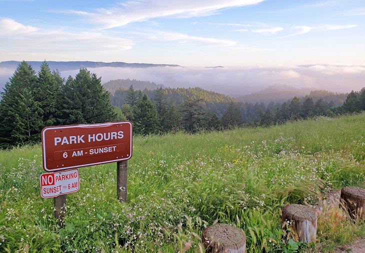
Hiking Trails near Santa Cruz, CA
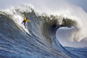
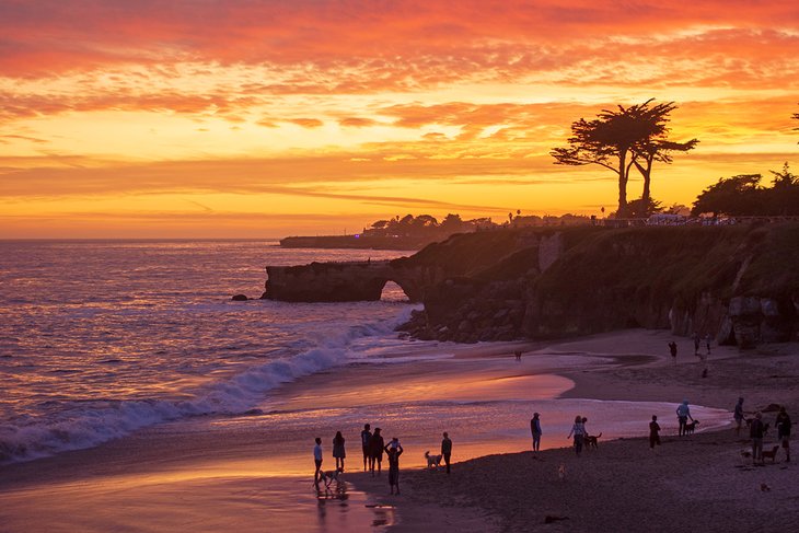
Hiking trails near Santa Cruz traverse a wide range of environments. They span 2,000-foot elevations in the Santa Cruz Mountains down to the ocean shore, leading to plunging waterfalls and stunning ocean vistas.
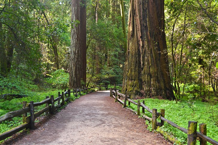
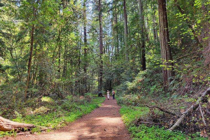
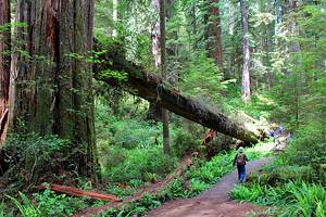
But magnificent redwood groves are perhaps the biggest attraction of hiking trails near Santa Cruz. These millennia-old trees, some rivaling the height of the Statue of Liberty, are world-famous and credited with kickstarting the California State Park system.
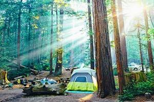
A great first place to head for hiking trails near Santa Cruz is Henry Cowell Redwoods State Park, less than 10 miles from downtown. It features family-friendly hikes through ancient redwood groves and one of the best campgrounds near Santa Cruz.
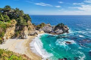
Many other hiking trails near Santa Cruz offer views of the ocean. And spots like Wilder Ranch State Park showcase some of the most beautiful coastal panoramas on this side of the country. Enjoy all the landscapes of the area with our list of the top hiking trails near Santa Cruz, California.
- Redwood Grove Loop Trail, Henry Cowell Redwoods State Park
- Sequoia Trail, Big Basin Redwoods State Park
- Old Cove Landing Trail, Wilder Ranch State Park
- Old Growth Loop Trail, Forest of Nisene Marks State Park
- Saratoga Gap Trail, Castle Rock State Park
- Skyline-to-the-Sea Trail
- Campground to Redwood Grove Trail, Henry Cowell Redwoods State Park
- Berry Creek Falls, Big Basin Redwoods State Park
- Fall Creek Trail, Fall Creek Unit, Henry Cowell Redwoods State Park
- Aptos Creek Fire Road, Forest of Nisene Marks State Park
- Quail Hollow Ranch
- Wilder Ridge Trail, Wilder Ranch State Park
- Pogonip Creek Nature Loop, Pogonip Open Space
- Peak Trail, Fremont Peak State Park
- West Cliff Drive, Lighthouse Field State Beach
- Map of Hiking Trails near Santa Cruz, CA
- Santa Cruz, CA - Climate Chart
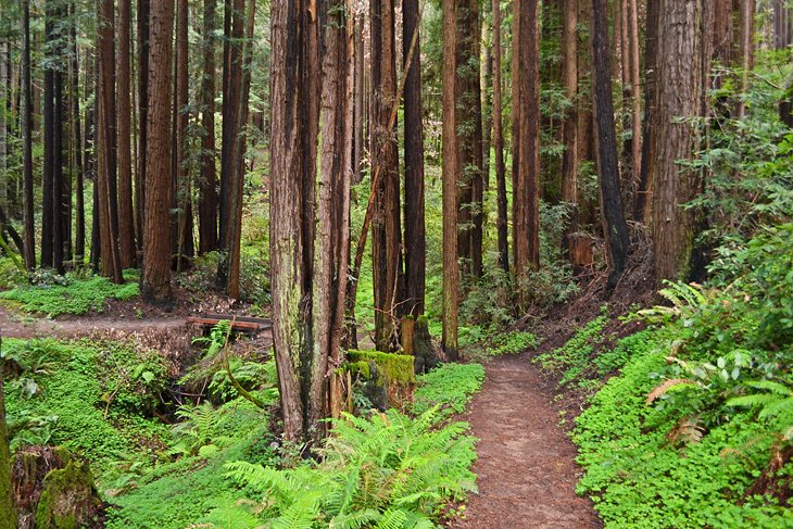
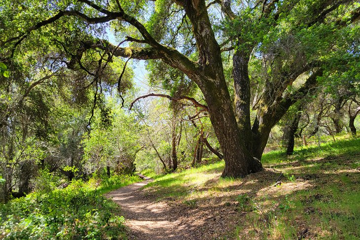
Redwood Grove Loop Trail, Henry Cowell Redwoods State Park
The Redwood Grove Loop Trail is the most popular hike at the world-famous Henry Cowell Redwoods State Park. This less-than-a-mile loop is right in the city's backyard, approximately a 7.5-mile drive from the Santa Cruz Beach Boardwalk.
The hike tours next to coastal redwoods exceeding 250-feet tall and provides interpretive information about the forest along the way. It's not a long trail, but plan to spend at least an hour admiring the many tall vantage points throughout.
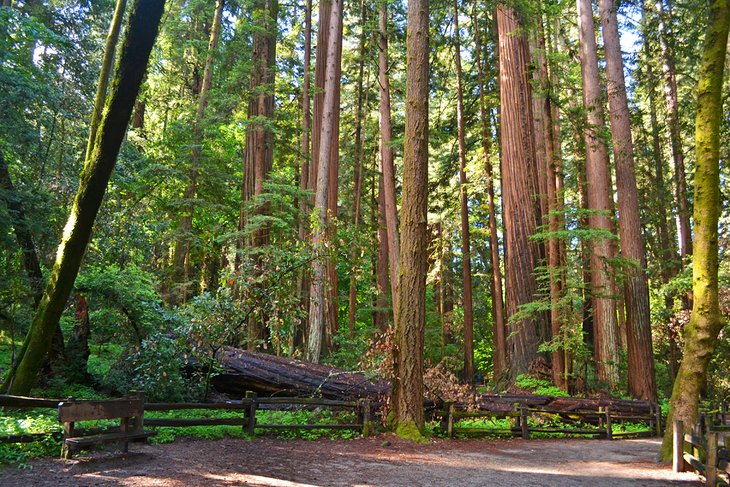
The Redwood Loop is one of many must-see Redwood trails in California, and only a small fraction of all there is to see within Henry Cowell Redwoods State Park.
Address: 101 N Big Trees Park Road, Felton, California
Official site: https://www.parks.ca.gov/?page_id=546
Sequoia Trail, Big Basin Redwoods State Park
The ancient redwoods within Big Basin, the oldest State Park in California, are attributed to jumpstarting the California State Park system. Over 80 miles of trails span this century-old state park, including the Skyline-to-the-Sea Trail that connects to other state parks in the area.
For a nice introduction to the park, the Sequoia Trail is a family-friendly, four-mile loop starting from the park's Sequoia Campground. The trail follows a road for half of the loop, exploring along the edge of an ancient redwood forest, with a level and well-maintained trail throughout.
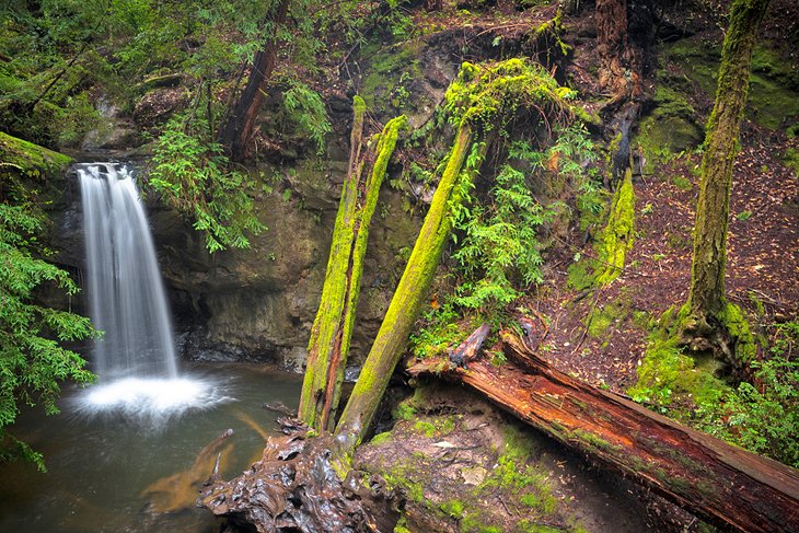
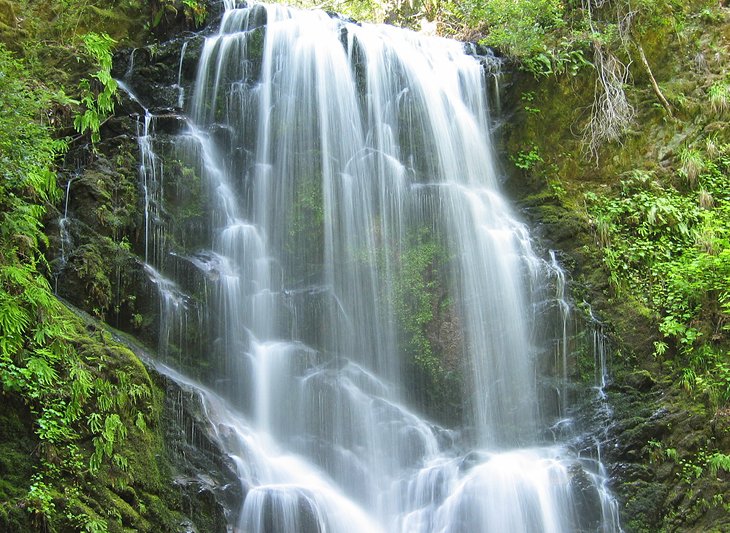
At the halfway point of the hike, a short descent takes hikers down to see Sempervirens Falls, a roughly 20-foot waterfall plunging into a forest grotto.
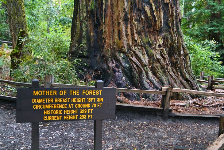
The universally accessible and half-mile Redwood Trail at Big Basin is another nearly required hike at the park. This quintessential hike leads to inspiring redwoods, like the towering "Father and Mother of the Forest."
Editor's Note: The 2020 CZU Lightning Fire Complex severely damaged Big Basin Redwoods State Park. The majority of the park remains closed during the 2022 season. Only small areas in the park's western coastal region have re-opened to the public. The state park maintains up-to-date information regarding the park's rehabilitation.
Address: 21600 Big Basin Way, Boulder Creek, California
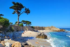
Old Cove Landing Trail, Wilder Ranch State Park
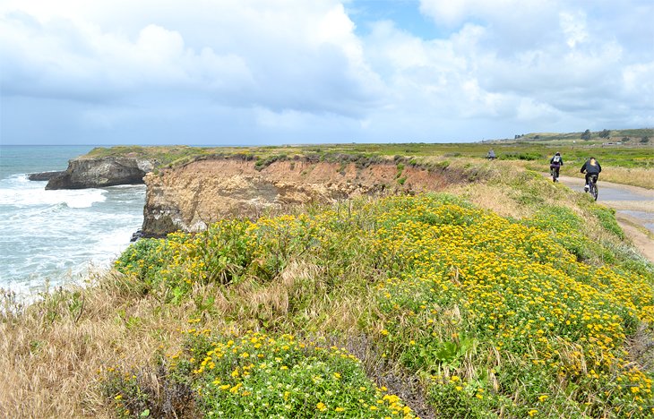
Wilder Ranch State Park offers over 7,000 acres to explore on the Santa Cruz coastline, extending to the crest of Ben Lomond Mountain. Thirty miles of trails navigate the ocean bluffs and generous forest encompassed by the park, as well as the late-19th-century preserved dairy ranch the park is named after.
Easily accessible from the parking lot, near the Wilder Dairy Cultural Preserve, the Old Cove Landing Trail is the signature hike of the area. A half-mile from the parking lot, the Old Cove Trail meets a bluff overlooking Wilder Beach. This stunning scene is now a protected snowy plover habitat and a beautiful place to view the ocean.
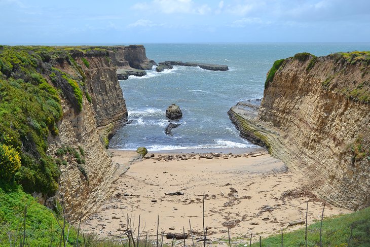
The trail follows the bluff's edge from Wilder Beach, quickly coming across the historic Old Cove Landing, where schooners used to come ashore. After following the bluff for about a mile, hikers can head back to the parking lot for a 2.5-mile loop or continue hiking the Ohlone Bluff Trail for more great views of the ocean.
Address: 1401 Coast Road, Santa Cruz, California
Old Growth Loop Trail, Forest of Nisene Marks State Park
This local favorite and hidden gem of a state park is located near Santa Cruz, just outside the small community of Aptos. With an extensive logging history, Forest of Nisene Marks now features numerous hiking trails and old forest roads leading to waterfalls, redwood groves, and views of the ocean.
Near the entrance station, the Old Growth Loop Trail is a moderately trafficked 2.2-mile loop showcasing some of the signature landscapes of the region. The Pourroy Picnic Area is a great spot for a picnic at the beginning of the trail, beneath several neck-craning redwoods.
Farther into the trail, hikers come across unique and scenic features like bridge crossings, twisted groves, and The Advocate-once the tallest tree in the park until felled by storms in 2017. For those looking to put in the extra mile, the Old Growth Loop connects with the Oak Ridge Trail for extended day hikes.
Address: Aptos Creek Road, Aptos, California
Saratoga Gap Trail, Castle Rock State Park
High up on the ridges of the Santa Cruz Mountains, Castle Rock State Park encompasses over 5,000 acres of rugged terrain. It's frequented by hikers, backpackers, and horse riders, and has over 30 miles of trails and two trail camps to spend the night.
Saratoga Gap Trail and Castle Rock Trail are two popular trailheads in the park, both accessible at the Main Park Entrance on Highway 35 (Skyline Boulevard). Castle Rock Trail is a short and level loop often used by rock climbers, who also flock to the area. Saratoga Gap Trail is a long-distance trail, with many users going as far as they choose before heading back.
From the Castle Rock Trail, hikers begin descending on the Saratoga Gap Trail, where panoramic vistas quickly unfold, including scenic overlooks of the San Lorenzo River. The trail passes by other photogenic features like Castle Rock Falls.
A six-mile loop is accomplished by utilizing the Ridge Trail back up to the parking lot, or hikers can continue farther on the Saratoga Gap Trail to the Castle Rock Trail Camp, where registered backpackers can spend the night with limited facilities available.
For a full day hike requiring a shuttle, the Saratoga Gap Trail stretches for a total of 18 miles end-to-end, making it one of the most difficult day hikes near Santa Cruz.
Address: 15000 Skyline Boulevard, Los Gatos, California
Skyline-to-the-Sea Trail
The name says it all for the Skyline-to-the-Sea Trail in Santa Cruz. It stretches from the 2,000-foot ridges found at Castle Rock State Park to the Waddell Beach region of Big Basin Redwoods State Park. It's a popular overnight backpacking route, and numerous shorter loops and day hikes utilize this approximately 30-mile path.
Trail camps along the Skyline-to-the-Sea Trail are by reservation only, with a wide enough variety to accommodate two-, three-, and multi-day trips. Because of its length and the need to carry overnight supplies, it's one of the more difficult hikes near Santa Cruz.
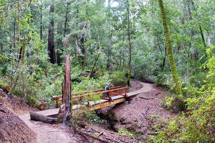
Campground to Redwood Grove Trail, Henry Cowell Redwoods State Park
The Graham Hill Campground at Henry Cowell Redwoods State Park has an awesome trailhead that accesses a sprawling network of hiking trails. Between sites 82 and 84, the trailhead leads towards an intersection with all paths heading to the San Lorenzo River or its tributaries.
The Redwood Grove Loop Trail, near the Park Entrance Station, is often a destination to aim for from the campground with a five-mile round trip. On the way to the Redwood Grove Loop from the campground, alongside a towering forest canopy, hikers come across and follow the banks of the equally scenic San Lorenzo River.
Another highlight in this network of hiking trails stemming from the campground is an Observation Deck overlooking an area known as the Santa Cruz Sandhills. Be sure to bring a trail map along for any hike, as there are several junctions throughout.
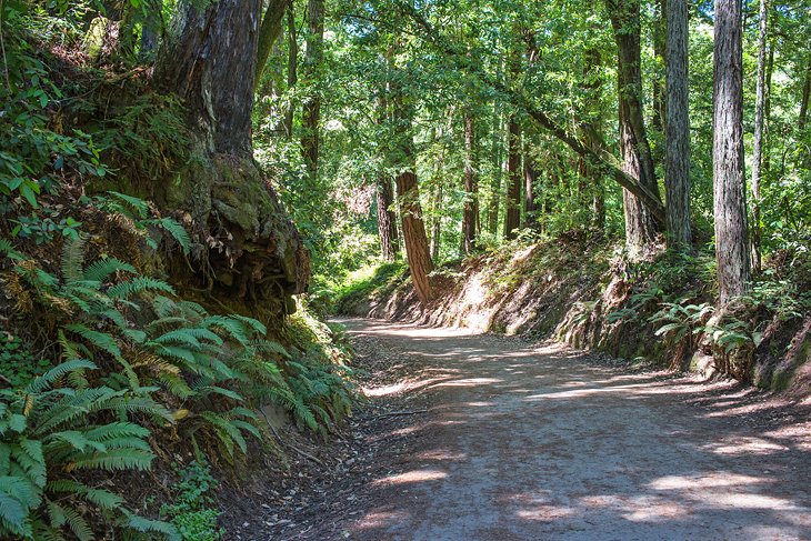
The popular Rincon Fire Road can also be accessed within this network of trails, offering a wide pathway and great exposure of the Santa Cruz Mountains.
Address: 101 N Big Trees Park Road, Felton, California
Berry Creek Falls, Big Basin Redwoods State Park
The 10-mile loop to Berry Creek Falls is a difficult hike near Santa Cruz. It takes hikers an average of six hours to complete, exploring deep into the 18,000 acres encompassed by California's oldest state park, Big Basin.
The trailhead is near the Big Basin Park Headquarters and utilizes portions of the Sunset Trail and Skyline-to-the-Sea Trail. Along the way, hikers pass into the non-developed West Waddell Creek State Wilderness portion of the park. A stunning redwood forest lines much of the trail, adding a surreal landscape of giant trunks and towering canopies.
The trail leading to Berry Creek Falls is popular on the weekends, especially the Skyline-to-the-Sea portion, but the set of four waterfalls near the turnaround point is well worth the small crowds. With a viewing platform available, Berry Creek Falls is a year-round hike, subject to landslide closures, with the falls flowing heaviest come winter.
Editor's Note: The 2020 CZU Lightning Fire Complex severely damaged Big Basin Redwoods State Park. The majority of the park remains closed during the 2022 season. Only small areas in the park's western coastal region have re-opened to the public. The state park maintains up-to-date information regarding the park's rehabilitation.
Address: 21600 Big Basin Way, Boulder Creek, California
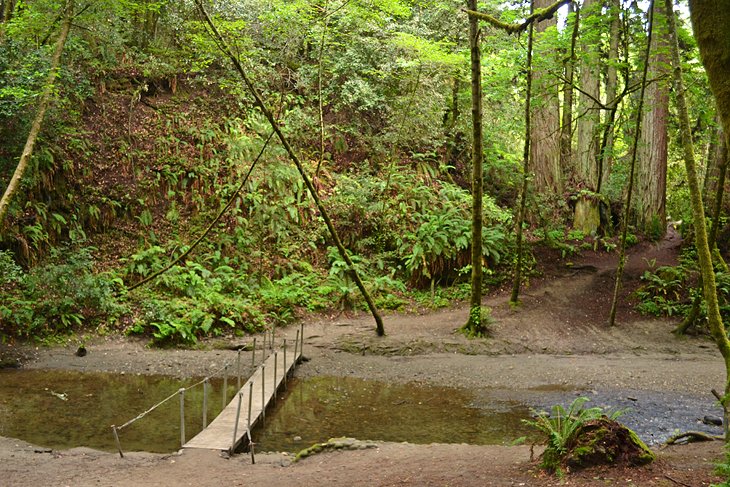
Fall Creek Trail, Fall Creek Unit, Henry Cowell Redwoods State Park
The Fall Creek Unit of Henry Cowell Redwoods State Park is designated as a day-use area and is a short drive north of the campground. It has an additional 20-plus miles of trails to explore.
The Falls Creek Trail follows the meandering water through the heart of this 2,000-acre park unit, connecting with numerous other trails along the way. This pathway adjacent to Fall Creek is wide and accommodating for the whole family, and the lush forest and fern canyon surrounding the water offers an enchanting world to walk through.
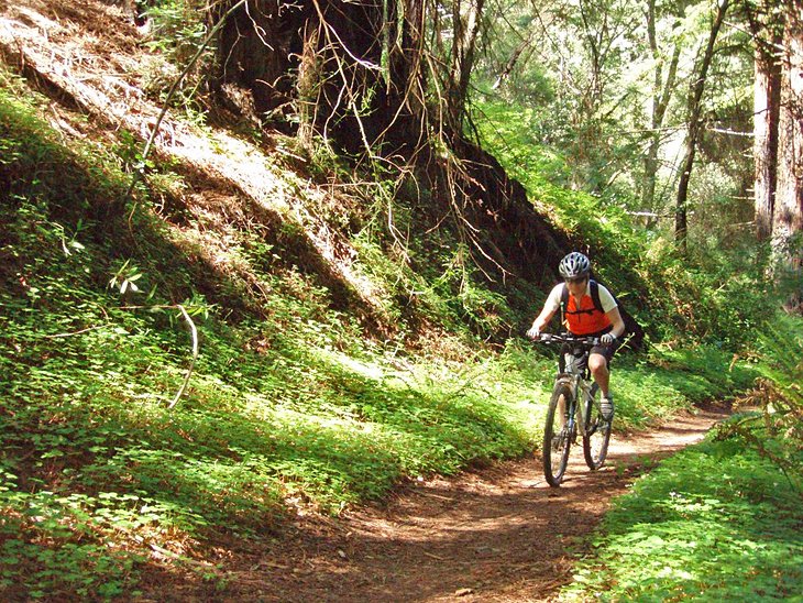
Aptos Creek Fire Road, Forest of Nisene Marks State Park
Numerous trails and fire roads lead deep into the local-favorite Forest of Nisene Marks State, making it a popular park with long-distance runners, hikers, and mountain bikers. The Aptos Creek Fire Road is the main hiking trail that explores the farthest reaches of Forest of Nisene Marks and connects with other long-distance trails in the area.
With steep sections throughout, Aptos Creek Fire Road climbs to near the summit of Santa Rosalia Mountain, where the nearby Sand Point Overlook provides distant views of the ocean. The Fire Road also connects to the West Ridge Trail Camp-the only place to spend the night within the park. The entire trail spans a total of approximately 11.5 miles, ending at Buzzard Lagoon Road
Other notable side-hikes stemming from Aptos Creek Fire Road include Five-Finger Falls and numerous historic sites, including the Loma Prieta earthquake epicenter. Near the trail's southern terminus, the popular 2.5-mile Old Growth Loop Trail within the state park offers much easier elevation to navigate.
Address: Aptos Creek Road, Aptos, California
Quail Hollow Ranch
Quail Hollow Ranch is a county park north of Santa Cruz, accessible on Highway 9 just east of Ben Lomond. It's a county park and a natural reserve, encompassing 300 acres of a former working ranch.
Quail Hollow Ranch is a bit of a hidden gem for hiking, with approximately five miles of routes to follow. And there's something for everybody, ranging from flat and wide ranch roads to strenuous uphill endeavors with a view.
The Discovery Loop Trail and Italian Trail are both good routes for a more leisurely stroll. Both traverse past ranch relics, including water tanks and stables. They both also lend an excellent preview of the lush environment and its many species of trees.
Sunset Vista offers arguably the best views in the park. It's approximately a three-mile loop to reach the vista via Sunset Trail and Woodrat Trail, with approximately 600 feet of elevation gain. Remember to bring a flashlight if you're visiting during the golden hour.
Wilder Ridge Trail, Wilder Ranch State Park
Alongside the oceanside Old Cove Landing and Ohlone Bluff Trails of Wilder Ranch State Park, this day-use only hiking destination has numerous trails that navigate the mountain slopes opposite Highway 1.
The Wilder Ridge Trail is a central artery in the network of these mountain trails, accessed by a pedestrian tunnel under the highway. On this unpaved road with moderate to strenuous elevation gain, stunning views of Monterey Bay reward hikers after about two miles of uphill hiking.
Address: 1401 Coast Road, Santa Cruz, California
Pogonip Creek Nature Loop, Pogonip Open Space
Pogonip Open Space is about 10 minutes from downtown Santa Cruz and provides a trail connection between UC Santa Cruz and Henry Cowell Redwoods State Park. The park encompasses over 600 acres and eight miles of trails, navigating through open meadows and a rolling landscape.
Pogonip is a popular outlet for stepping out of the city and a popular place to start exploring is the Pogonip Creek Nature Loop. This wide and flat path connects with many other trails, like the woodland Fern Trail, to extend a hike.
Address: 333 Golf Club Drive, Santa Cruz, California
Official site: http://www.cityofsantacruz.com/government/city-departments/parks-recreation/parks-beaches-open-spaces/open-spaces/pogonip
Peak Trail, Fremont Peak State Park
Fremont Peak is high above the Salinas Valley southeast of Santa Cruz, accessible with approximately a 60- to 90-minute drive. It's the highest point along the Gabilan Range, rising to 3,169 feet, and provides spectacular views of the lush and mountainous region, including Monterey Bay.
Visitors gain much of the peak's elevation by driving or bicycling up San Juan Canyon Road. This winding road with hairpin turns isn't recommended for trailers or larger vehicles. Big vistas await those that make the commute, but the best views come from the Peak Trail extending from the end of San Juan Canyon Road.
It's a 1.2-mile round trip to the actual peak, following the single track Peak Trail. It's only 300 feet of elevation gain, making for a moderate hike.
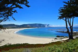
West Cliff Drive, Lighthouse Field State Beach
West Cliff Drive isn't a traditional hike, but it is a quintessential bike trail for exploring the outdoors of Santa Cruz. This seaside route spans just over three miles from Natural Bridges State Beach north to the San Cruz Wharf.
The seaside bicycle path is mostly flat and very popular throughout the week. Expect other users sharing the trail. Also expect surfers in the water, especially at Steamer Lane at Lighthouse Field State Beach. Here, the retired lighthouse now serves as the Santa Cruz Surfers Museum.
Map of Hiking Trails near Santa Cruz, CA
Santa Cruz, CA - Climate Chart
| Average minimum and maximum temperatures for Santa Cruz, CA in °C | |||||||||||
| J | F | M | A | M | J | J | A | S | O | N | D |
| 16 4 | 17 6 | 18 6 | 21 7 | 22 8 | 23 10 | 24 12 | 24 12 | 24 11 | 23 9 | 18 6 | 16 4 |
| PlanetWare.com | |||||||||||
| Average monthly precipitation totals for Santa Cruz, CA in mm. | |||||||||||
| 165 | 156 | 121 | 50 | 18 | 5 | 4 | 3 | 10 | 37 | 104 | 107 |
| Average minimum and maximum temperatures for Santa Cruz, CA in °F | |||||||||||
| J | F | M | A | M | J | J | A | S | O | N | D |
| 61 40 | 63 42 | 65 43 | 69 44 | 71 47 | 74 50 | 75 53 | 76 53 | 76 52 | 73 48 | 65 43 | 61 40 |
| PlanetWare.com | |||||||||||
| Average monthly precipitation totals for Santa Cruz, CA in inches. | |||||||||||
| 6.5 | 6.2 | 4.8 | 2.0 | 0.7 | 0.2 | 0.1 | 0.1 | 0.4 | 1.4 | 4.1 | 4.2 |
More Related Articles on PlanetWare.com
Camping near Santa Cruz: One of the best ways to experience all the hiking trails in the area is by spending the night at one of the best campgrounds near Santa Cruz. For more camping options on the California coast, Big Sur Campgrounds deliver on more amazing landscapes where the mountains meet the sea. For further redwood appeal and campsites next to towering trees, these beautiful campgrounds in Redwoods State and National Parks deliver on great places to pitch a tent or park an RV.
More Hiking Trails in California: The best hikes in Redwood National and State Parks lead visitors to dense redwood groves, fern canyons, and excellent ocean vistas. To explore some of California's national parks to the east, hiking trails in Yosemite National Park deliver on some of the most iconic Sierra Nevada Mountain scenes in the state. For a look at the wide diversity of landscapes offered by hiking trails in the state, the hiking trails in California span everything from high mountain peaks to low desert valleys.