12 Best Hikes in Vail, CO
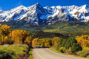
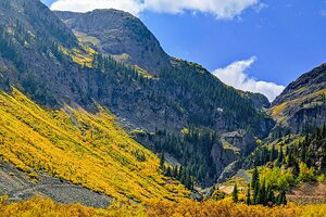
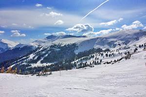
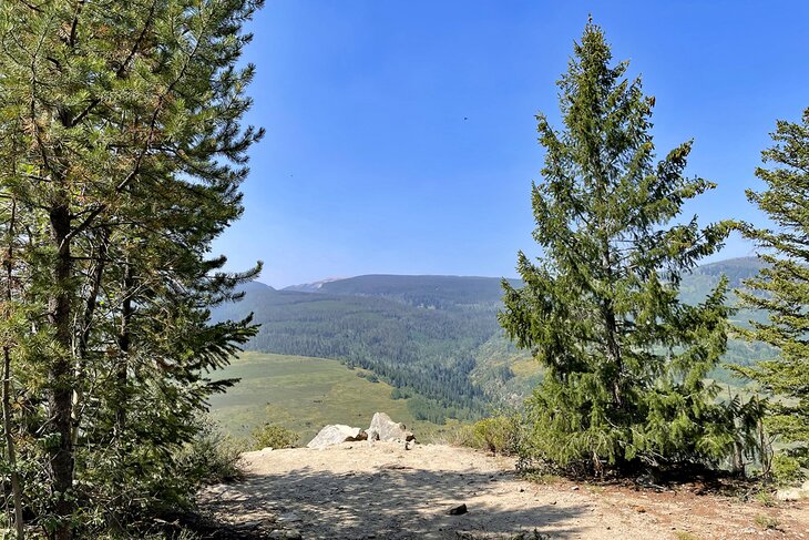
Famed for its mountainous terrain, alpine lakes, wildflower-carpeted meadows, and lofty peaks, Vail is home to some of the most picturesque and challenging hikes in America. For outdoor adventurers, this mountain mecca is a playground of epic proportions.
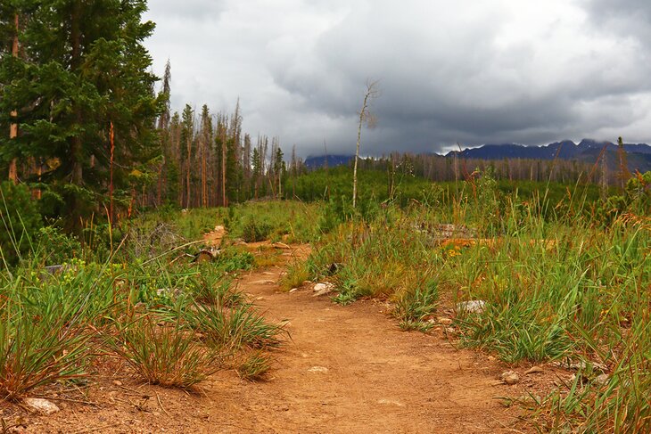
Vail is home to some of the most challenging day hikes in Colorado but also features hikes that are far more gentle and approachable to even the most inexperienced hikers.
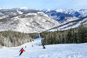
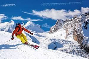
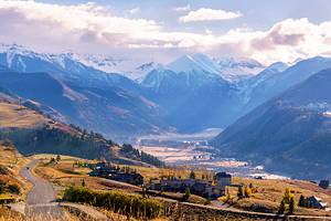
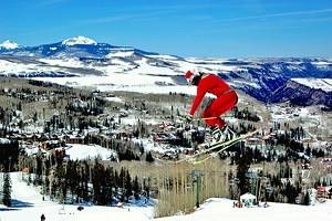
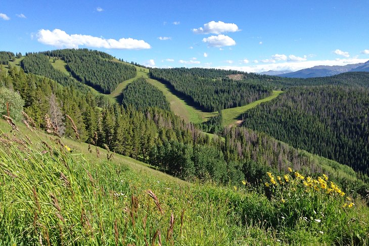
While Vail is predominantly known for its world-class skiing, the mountain resort town is just as beckoning in the summer months, meaning the destination is busy year-round with plenty of things to do. You can take the scenic gondola up to the top of Vail Mountain to explore the many trailheads along its slopes, or you can venture to the nearby towns and forested areas that are also peppered with trailheads.
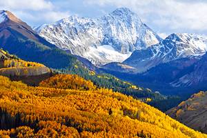
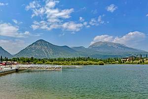
Flex your skills scaling elevations of more than 3,000 feet to reach jewel-colored lakes, or disappear deep into aspen groves to hike alongside wildflower paths and babbling creeks. You can even head into the nearby town of Avon for a leisurely stroll around Nottingham Lake complete with mountain views. When it comes to experiencing the Gore Range, Vail truly has a hiking trail for everyone.
For a closer look at the trails, see our list of the best hikes in Vail.
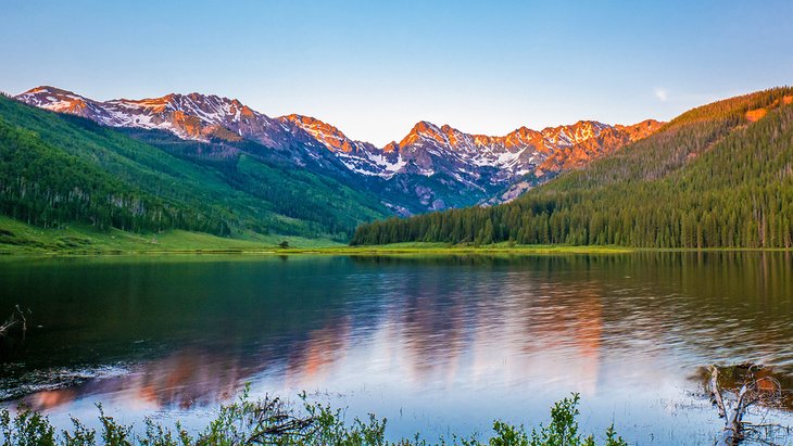
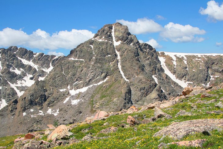
1. Booth Lake
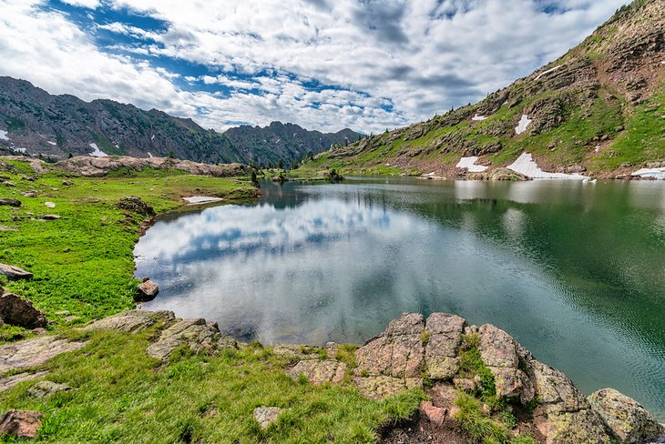
Just outside Vail Village is the hilly trailhead that leads up to the stunning, remote Booth Lake. The Booth Lake trail is a 10-mile, out-and-back trail that is one of the most popular hiking trails in Vail. It runs in conjunction with the Booth Falls trail and continues on to Booth Lake.
The trail is considered to be fairly difficult, with an elevation gain of 3,051 feet. However, those who make the trek are rewarded with absolutely gorgeous views of the mountains as they wind their way up the dirt path that is strewn on either side with brilliant wildflowers.
The trail is a mix of exposed paths, as well as parts that wind in and out of aspen and pine groves. The Vail valley views are among the best you'll find on foot. About two miles in, you'll hit the 60-foot Booth Falls, and here is where most hikers turn around. But if you keep going up the aggressive incline, you'll reach the lake, which is wreathed in towering peaks.
Beware, though, as the lake is rumored to be guarded by a cranky group of mountain goats, who may try to bully you out of the idea of camping there.
2. Nottingham Lake Trail
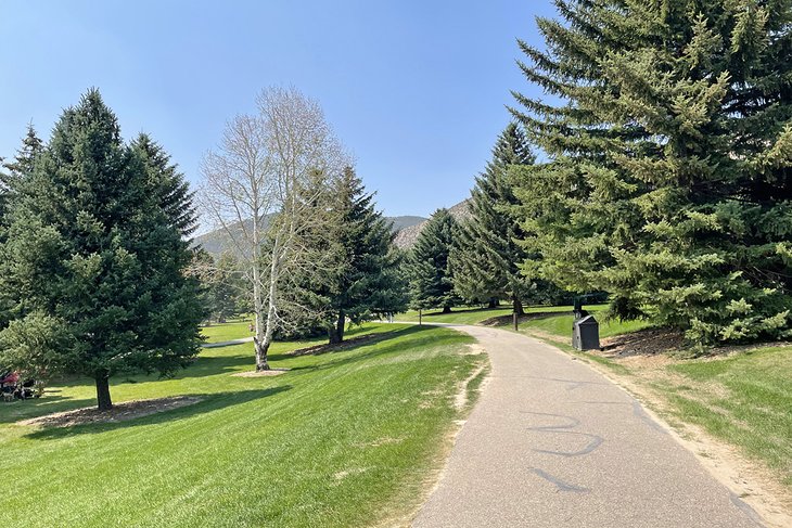
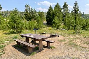
Not all hikes have to be mega-intense. A beautiful stroll around Nottingham Lake can give you a quick lay of the land, while drinking in some beautiful views and scenes of daily life in Vail.
The Nottingham Lake trail is a mile-long loop that is perfect for all skill levels, and, honestly, is just a nice way to spend an afternoon, especially if you're sore from that seven-miler you did this morning.
The trail is the focal point of Nottingham Park, as it loops around the lake by the same name. The paved path provides scenic views of the surrounding mountains, and you may even catch a glimpse of visitors playing volleyball, sunbathing, or picnicking on the grass. Dogs are permitted, provided they are kept on a leash.
The trail is one of the most gentle in the area, with only a 22-foot elevation gain, so this is perfect for those with limited mobility or with strollers in tow.
3. Cougar Ridge
A short drive outside Vail brings you to the trailhead for Lionshead Rock via the Cougar Ridge trail. This 6.2-mile, out-and-back trail is considered to be moderate, with an elevation gain of 2,073 feet.
The switchback trail can be steep at times, but hikers are rewarded with spectacular views. The first view you come upon, for example, is pretty awe-inspiring, with visibility towards the small towns below and the Gore Range in the distance.
You can combine a series of sites that include Cougar Ridge, including the Minturn Mile, which is one of the most famous "out-of-bounds" ski runs in the world. During the hiking months (when snow is gone), the Minturn Mile is also known as the Game Creek Trail — but more on that later. You can even hike from the town of Vail to Minturn via the Berrypicker Trail on Vail Mountain. Descend via Cougar Ridge and end in Minturn. This turns the moderate hike into a more difficult one, with an elevation gain of 3,172 feet.
Many hikers (and the occasional mountain biker) take on Cougar Ridge Trail to head to Lionshead Rock. The views from the top of Lionshead Rock are breathtaking.
4. Davos Trail
One of the most popular hiking trails in West Vail, the Davos Trail packs a punch for lovers of wildflowers; aspen groves; and hushed, sky-soaring peaks. No matter the season, the Davos Trail is popping with activity, whether it's hikers or trail runners, mountain bikers, or snowshoers in the winter.
Davos Trail is about 5.4 miles round trip, with an elevation gain of less than 1,000 feet, but is still characterized as a moderate trail. It follows a dusty Jeep road, and much of the beginning is exposed, so make sure to bring the sunscreen or anything else you may need to protect from sun exposure.
But what you're in for is expansive views in every direction — you may even be able to see the town of Minturn, Notch Mountain, Meadow Mountain, and Beaver Creek. The trailhead begins at the end of Cortina Lane near West Vail. As you set off on the trail, you'll see a split off for the North Trail, but if you keep continuing on Davos, another section of the North Trail will link up.
Davos Trail is dog-friendly, so definitely feel free to bring yours along with you. Just bear in mind that the trail is used by many different types of transportation — biking and 4x4s included.
5. Game Creek Trail
To follow Game Creek Trail, you'll head to the same trailhead for Cougar Ridge. It's located in Minturn outside of Vail. The other option is to take the Eagle Bahn gondola to the top of the mountain and hike your way down. Either way, this is a dramatic ascent/descent, with an elevation gain of almost 2,400 feet.
The seven-mile out-and-back trail is considered moderate, and is one of the most popular hikes in Vail thanks to the gorgeous views and fields of wildflowers, aspen groves, and pine forests you encounter along the way. This is a popular trail for mountain bikers, too, so be aware that you may encounter a few along the climb.
If you are beginning (or ending) near Minturn, bear in mind that the first part of the trail goes behind private property. Signs are posted along the way, so you know when you are officially entering and leaving the private grounds.
Of course, it's more challenging to do the hike from start to finish in Minturn, but you'll still be able to appreciate the beauty and remote vibe of the trail if you start at the top and work your way down.
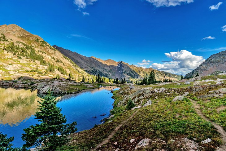
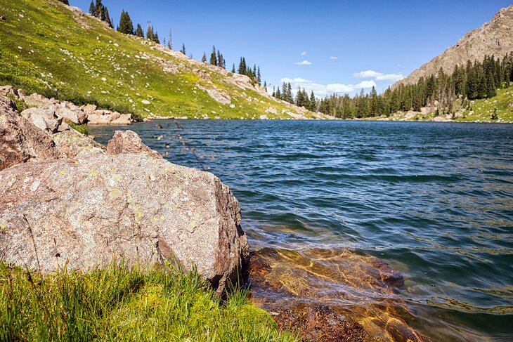
6. Upper Piney River Falls Trail
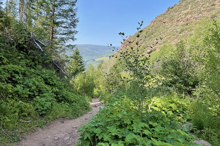
One of the best, and most rewarding, hiking trails in the Vail region is the Upper Piney River Falls Trail, which leads to the very beautiful Piney Lake. The 5.9-mile out-and-back has an elevation gain of 728 feet and plunges deep into the Eagles Nest Wilderness area.
The trail kicks off at the entrance to the Piney River Ranch — and getting there is no easy feat. You'll need a four-wheel drive to comfortably get up the rocky road. Once you're there, the beginning of the trail is a gentle roll of incline and decline before it starts to escalate up through flickering aspen groves to the soundtrack of babbling creeks and a plunging waterfall.
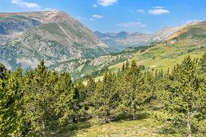
Along the way, you'll emerge upon Piney Lake, surrounded by the stoic, and impressive, lofty peaks of the Gore Range. In fact, this trail features one of the best views of the Gore mountains in Colorado. The last half-mile of the hike is along a giant plate that leads back into the trees along the Piney River.
7. Pitkin Lake Trail
One of the more challenging hikes in Vail, Pitkin Lake Trail is a 10.5-mile, out-and-back trail that carves its way through Eagles Nest Wilderness. The difficult trail gains nearly 3,000 feet in elevation and is most popular between the months of June and October.
What's great about Pitkin Lake Trail is that it provides all the challenges and views of a backcountry hike, yet it can be done as a day hike. Hikers will max out at 11,300 feet, which means that you'll have views from every angle of East Vail and the Gore Range. You'll also wander through enchanted aspen groves, meadows, and thick conifer forest.
The most intense part of the hike is the first half-mile, which gains 600 feet immediately. After the initial incline, the trail weaves through various forests, meadows, and tundra-style landscape. From 10,000 feet, you will have a wonderful view of Pitkin Falls.
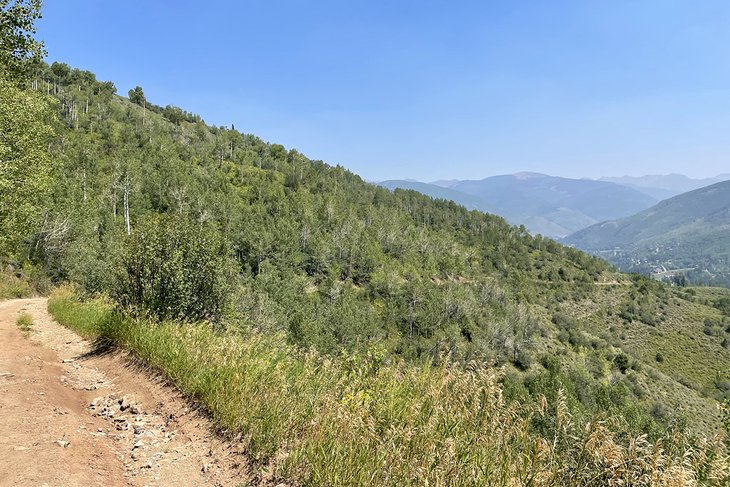
8. Berrypicker Trail
Berrypicker Trail follows nearly eight miles of wildflower-strewn path up in the mountains outside of Vail. The out-and-back trail is a difficult but popular trail that has an elevation gain of 2,286 feet. However, if you're looking for an easier version of the hike, you can start it or end it with a gondola trip during the season when the gondola is running.
The beginning portion of the trail is considerably rocky with several stream crossings. Along the way, you'll encounter several switchbacks that zigzag through aspen forest. As you move farther into the forest, you'll start to have impressive views over the Gore mountains.
Bring sunscreen for the end of the trail, which is considerably more exposed. From the top, the views are simply sensational. You can opt to turn around and hike down, or take the gondola back to the beginning.
One thing to note is that this trail crosses with service roads and mountain biking paths, so it's best to always keep a lookout.
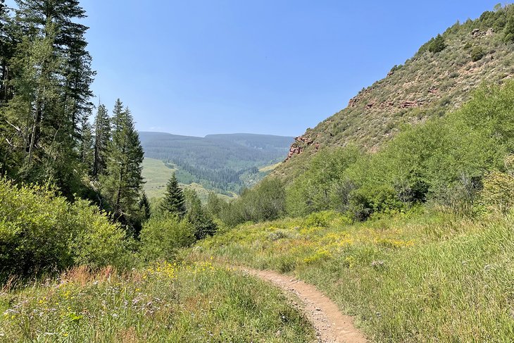
9. Fall Creek Trail #2001
For nearly nine miles of trail, the Fall Creek Trail is one of the most beautiful in the Holy Cross Wilderness near Vail. The out-and-back route can be done in either direction, whether from the Half Moon Trailhead or the Hunky Dory Trailhead.
Either way, before long hikers will find themselves ensconced in the Gore Range, which is blanketed with wildflowers, babbling with streams, and completely surrounded by glacial peaks. If coming from Half Moon, you'll cross the Notch Mountain Trail at roughly two miles in. But stick with the Fall Creek Trail to reach Lake Constantine — a beautiful spot for picnicking, fishing, or spending the night.
As you continue to Hunky Dory, you'll find the trail is much quieter. You'll also pass the trail to Tuhare Lakes. After crossing Fall Creek, the trail escalates up to 12,580 feet at Fall Creek Pass, which provides some of the most dramatic alpine landscape in the area.
Along the descent, you will follow French Creek to Hunky Dory Lake, which is not far from the Hunky Dory Trailhead and the end of the trail.
10. Shrine Ridge Trail
Named Shrine Ridge for the epic views over Mount of the Holy Cross, this is one of the most historic and beautiful trails in Vail. It was originally used by the Ute tribe and later silver miners and settlers. Stick with the trail for as long as you can because you will be rewarded with 360-degree views from the top of Shrine Mountain overlooking the Gore Range, Copper Mountain, Ptarmigan Hill, Sawatch Range, and the Flat Top Mountains.
The Shrine Ridge Trail is a 4.3-mile, out-and-back trail with an elevation gain of 1,030 feet. It's one of the more popular trails in Vail because of the kaleidoscope of wildflowers that lead the way.
After covering the forested portion early on in the journey, the trail opens up to an exposed portion with the ridge above. This rocky cliff climb leads to the saddle, with epic views in every direction. Stay on Shrine Ridge Trail to get to the summit, which is where the panoramic views are only more spectacular.
11. Lost Lake Trail
Lost Lake Trail is actually very close to the Upper Piney Trail. That said, it gets about a fraction of the crowds. This means you're treated to jaw-dropping views but with far fewer people.
The Lost Lake trail is about seven miles round trip with an elevation gain of 941 feet. It takes about three hours to complete. Along the way, you'll be treated to the very best buffet of Colorado visuals — streams, a waterfall, towering peaks, and a glassy lake that acts like a natural mirror on a calm day.
If you're feeling particularly intrepid, you can camp the night at Lost Lake, which is great in the summer, particularly if you're looking to take a refreshing dip.
12. Willow Lakes
If you're up for a challenging hike that rewards with absolutely awe-inspiring views, you'll want to hike to Willow Lakes via the Gore Range Trail. This hard route is 11.6 miles, out and back, with an elevation gain of more than 2,700 feet.
Not for the faint of heart, the six-hour hike is something truly special as you dive deep into the Eagles Nest Wilderness. It's an ambitious hike, but one that will be worth the effort for its three stunning lakes wreathed in massive, imposing peaks.